|
FINDING THEIR WAY by Bob Brooke Today, many people use GPS programs to find their way, but back when the automobile first came into existence, the road map became an essential tool to finding their way around. Prior to the mid-1890s, bicyclists were the ones who demanded good road maps. The systematic mapping of roads and the installation of route signs by the U.S. Government didn’t occur until the automobile arrived. But as the new century dawned, the number of automobiles on American roads began to increase and so did the demand for accurate road maps. The Chicago Times-Herald printed the first automobile road map in the country for a race they sponsored from Chicago to Waukegan.
In 1918, Wisconsin’s state legislature created a numbered highway system., which the federal government adopted in 1926. This new national highway system included such legendary roads as Route 66 and California’s scenic Highway 1. Rand McNally became the first major map publisher to adopt the system, which it also helped promote by installing numbered signs along these national roadways.
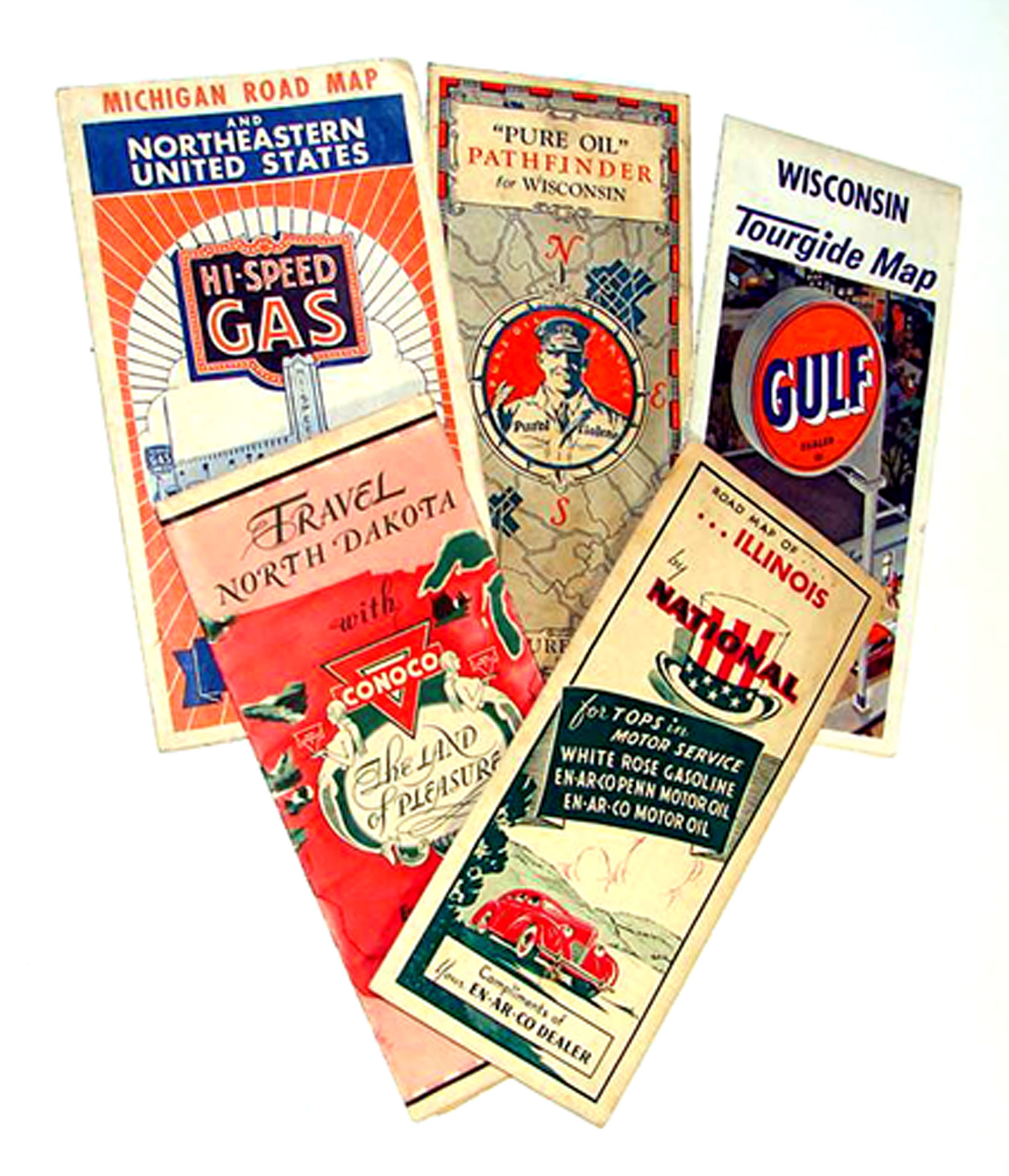
Some of the most rare and most historically interesting service station maps are those produced between 1920 and the end of World War II. This golden age of service station maps produced some with superb Art Deco designs and images of old autos. After the War, and especially with the expansion of the federal highway system in the 1950s, illustrations on maps featured dynamic scenes and graphics printed in vibrant colors. But after 1965, the quality of service station maps declined until their virtual disappearance in the 1980s. Oil producers such as Esso, Chevron, Shell, Gulf, Standard, Texaco, and Socony- Vacuum—later known as Mobil—all distributed maps. In addition, banks, auto clubs, and tourist agencies gave out maps to their customers and members. Road maps belong to the growing category of collectibles called "petroliana," or anything to do with gas stations and the petroleum industry. For the most part, they’re reasonably priced, and some estimate that during their peak service stations distributed over eight billion. Oil companies provided them as a service. They were made to be disposable, marked up by the gas station attendant as he gave directions and sent his customer on their way. But people often saved maps as souvenirs of the trips they made.
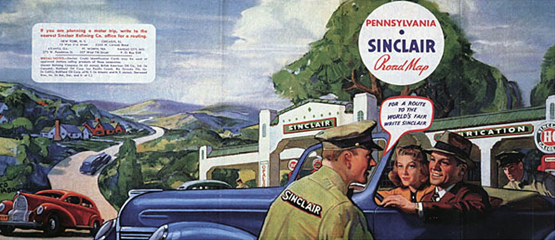
In 1925, states began numbering their roads. At first it was an adventure to drive, but by the 1930s it had turned into a method of tourism. Tourist cabins and cafés sprang up along the way, as motorists made their way across country. Historians consider this time the road map’s golden age. The Sinclair Oil Company hired noted artists like Peter Helck, who also produced advertising illustrations for car companies. Maps featured images of a carefree and playful life on the road, with service stations welcoming children and dogs, many of which were Scottish terriers, like the ones popular in movies like "The Thin Man." Map covers also featured idyllic illustrations of gently rolling hills and beckoning horizons.
In the 1920s, maps also often showed airplanes, boats and other exciting vehicles that used the fuel and oil produced by the company issuing the map. Graphic design became more sophisticated by the 1930s, often believed to have been the golden era of the map. Among the most sought-after items are the large five-panel maps of the 1930s issued by the Sinclair Oil Company, which hired artists like Peter Helck, a well-known painter also noted for his advertising illustrations for car companies. Maps produced during World War II reminded motorists to slow down to save tires. After the War, maps featured dynamic scenes, vibrant colors, and great graphics.
Three companies—Rand McNally, H. M. Gousha, and General Drafting— produced most of the service station maps. These became a vehicle through which oil companies could promote the service at their stations, for it was service that differentiated them. General Drafting produced maps for Esso, whose attendants handed out some 34.5 million maps in 1965. After 1965, the quality of service station maps declined until their virtual disappearance in the 1980s. Today, of course, free maps are long gone. They faded away, along with so many other aspects of the highway culture, with the 1973 energy crisis.
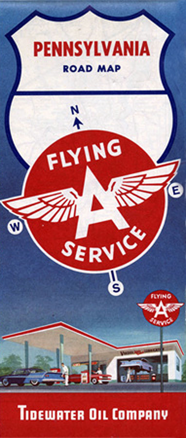
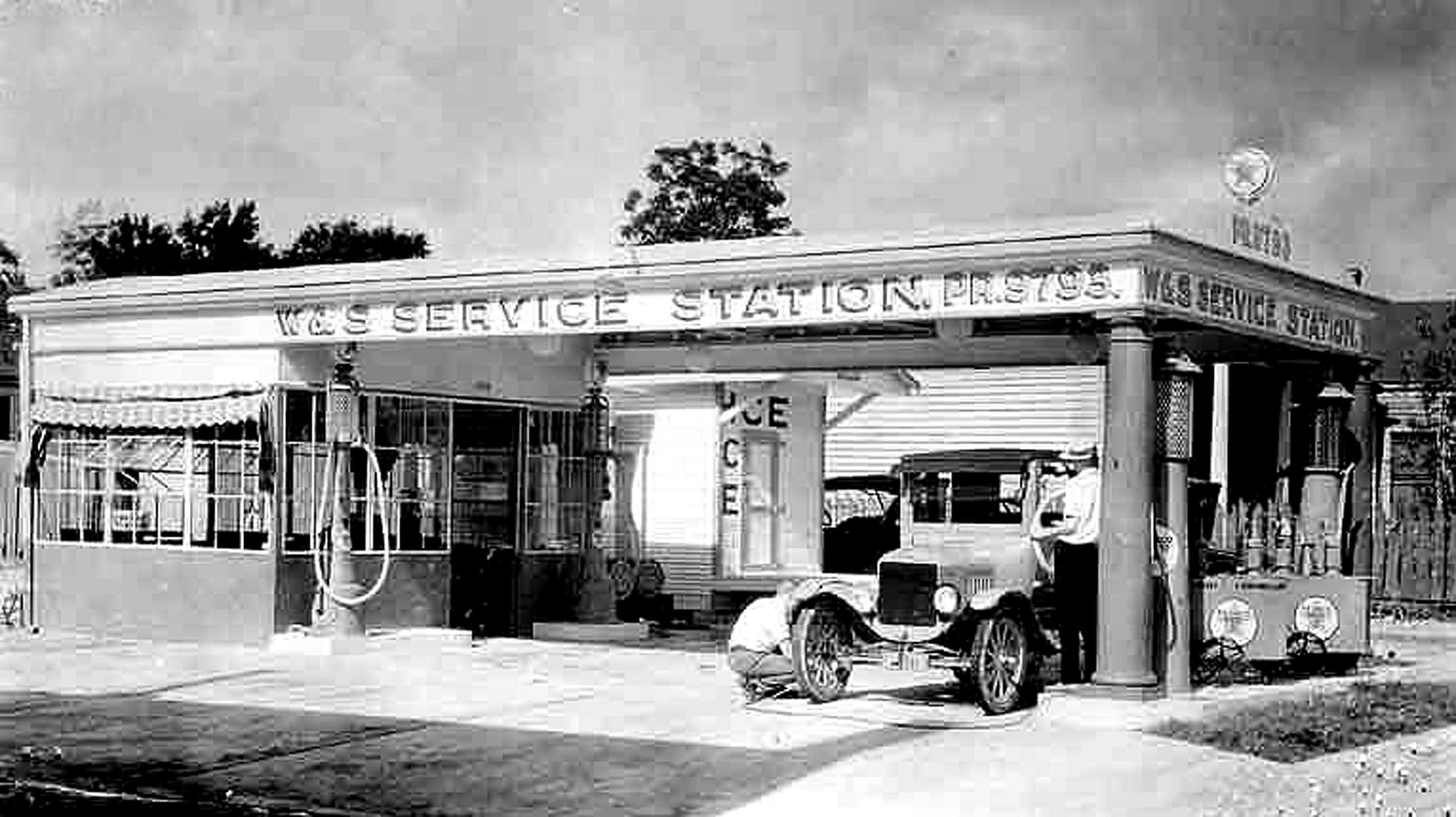
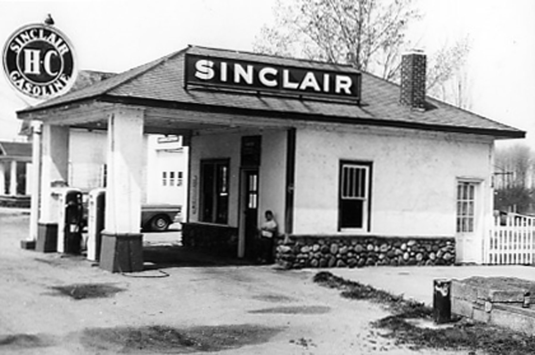
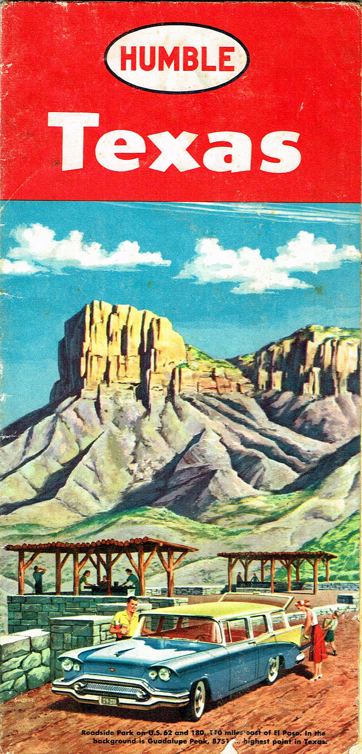
It’s often possible to date service station road maps by the name of the oil company. For instance, Esso became Exxon in 1973. Other service station maps, like Sinclair, Tydol, Flying A disappeared from large portions of the country in the 1960s when they lost market share. While older ones can be worth higher amounts, depending on their condition, newer ones aren’t as pricey. Early road maps from the first decade of the 1900s can be worth $75-100 today in good condition. Those from the 1920s and 1930s range in price from $20-40. Groups of maps from the 1950s sell for $10-20. Most of the damage to road maps occurred in their refolding, for few motorists ever mastered the art of folding a map correctly after use. Illustrations: The Sinclair Oil Company hired noted artists like Peter Helck, who also produced advertising illustrations for car companies. Road maps such as this one illustrated the future of automobile travel with modern service stations along the way. Road maps, especially the ones produced by oil companies for their service stations, are highly collectible. An old photograph of an early Texaco Service Station. A photograph of a Sinclair Oil Service Station. Humble, one of the many oil companies in the southwest, gave away this Texas road map to its customers. |